July 2, 2005. Day 12
Every so often, when I'm out touring, I get the urge to go play. This only happens about ten times a day. I rarely act on this because my schedule is so tight and I'm not supposed to be driving around putting hundreds of miles on my truck to go play -I'm supposed to be working. Once in a while though, I give in to these urges and I take off a little early from an appearance and head for a wild spot where there is more nature and less human.

Last June, while in Moab, I did just that. I packed up my flutes and headed north out of town. Just after crossing the Colorado river I turned left onto Potash road.
Potash road.
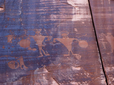
Potash road runs along the north side of the Colorado and passes some very nice petroglyph panels. They're right by the road. So close that if you get out to look at them you have to keep an eye out for cars driving by.
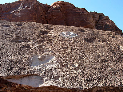
A little farther down from the petroglyph there are some dinosaur footprints. I'd say this guy wore a size 50 shoe.
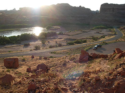
A couple miles down the road there was a small dirt parking lot and a sign marking the trail head to Corona Arch. I had overheard some people in town saying how nice the arch was, but I wanted to see how far Potash road went, so I kept on driving. Soon, however, the paved road ended at the potash plant and became dirt. I realized that from this point on it continued into Canyonland NP and as it was about 5:00 pm I didn't have enough time for to really explore to road any further .
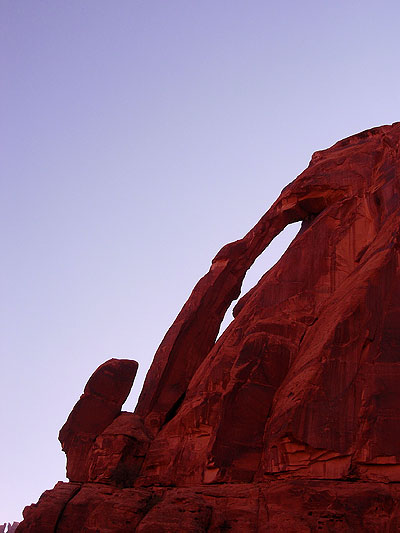
Before heading back I took some photos of a thin arch visible from the side of the road, when the Corona arch popped into my mind again. Ever since I had seen the trail leading off to it I couldn't get rid of the desire to hike out and see it. So when I got back to the trailhead I pulled my truck off into the parking lot, grabbed some water and my camera, and headed out.
The trail to Corona Arch
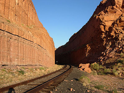
The hike started up a little hill and at the top, I was surprised to find the trail crossing some railroad tracks! The tracks, it turns out, were there for trains that haul potash from plant I'd seen at the end of the road.
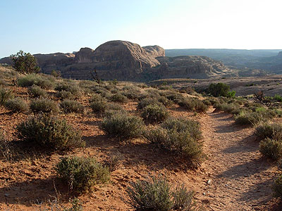
The trail continued up a small side canyon and then came out on a flat area covered with small scrub and a dusty trail. I was completely alone. The trail crested a shallow rise and in the distance some cliffs with large alcoves came into view. For a while the trail kept heading toward them but soon it begin to curve off to the left, where after rounding a bend, I caught my first glimpse of Corona arch about a half mile up a canyon.
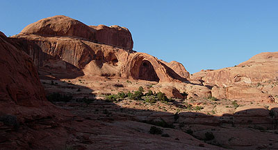
Even at that distance the arch looked huge, as big as any arch I'd ever seen. Picking up my pace I hoped to get up to it before the sun set behind the cliffs. The trail got rougher as it came upon some small ledges that were not passable without rock climbing gear. Luckily someone (the BLM) had run a chain-link hand rail attached to some posts sunk into the stone to aid the average hiker like me scale the rocks. Farther on there was a metal ladder for an even stepper ledge.
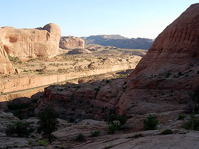
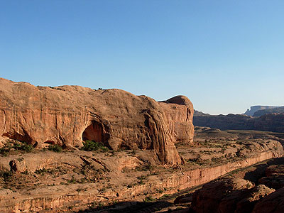
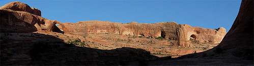
The trail then begin to cross a shallow lip between cliffs on my right and a canyon on my left. Looking back across the deep narrow canyon were the cliffs and alcoves I had seen before. I later learned this canyon was called "Bootleg Canyon". At the bottom of the Bootleg canyon ran the railroad tracks I had crossed at the start of the trail. The tracks continue up the canyon and through a one mile long tunnel until they reach Highway 191 and head toward Crescent Junction at Interstate 70. The Trains run several times a week hauling potash from the plant. Luckily for me, they weren't running that day.
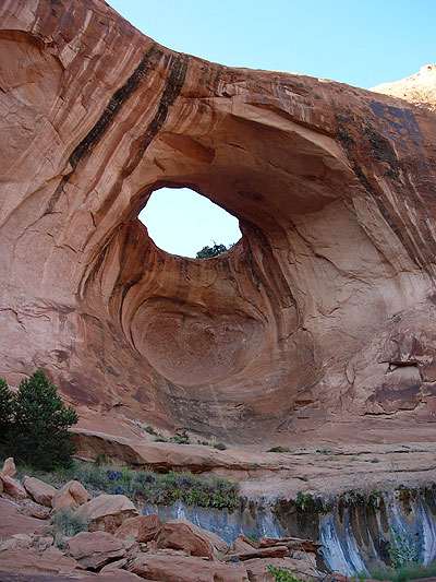
I passed Bowtie arch on the way to Corona arch. One of the fun extras of the hike.
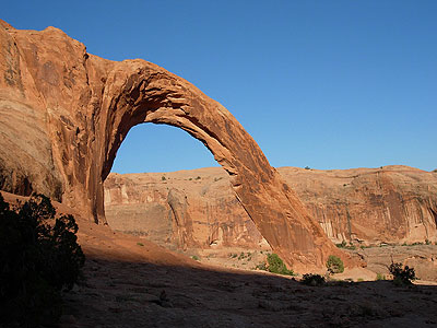
All the while I was getting closer to Corona arch, and it was getting bigger and bigger all the whole time. It was huge. Sculpted from Navajo sandstone it is also called "little rainbow arch" but it's far from little, it's opening being 140 ft by 105 ft. Rumor has it a local airplane pilot flew a small plane through it! Corona arch is a buttress arch as one end is set in the cliff face. It is one of the biggest arches I've ever seen as I climbed underneath it to get to the other side. I wanted to find out if the arch lived up to it's name.
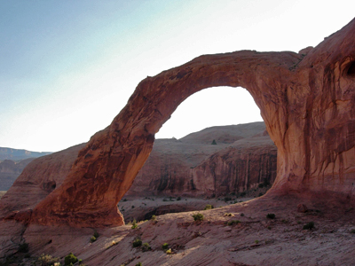
Once I got far enough past it to be able to get the whole arch in a photo I turned around and was stunned by the beauty. The setting sun cast a glow of radiant light around the arch like a halo and the world seemed to enter a dimension of timelessness. Except for the far off cries of the local ravens there was only the silence of the breeze and lengthening shadows to keep me company. The arch stood passive. Unmoved by anything but time measured in millenniums.
After the sun had dropped below the cliffs I headed back to my truck in order not be be caught in the dark. On the way back I passed a couple hiking in with their dog, a chocolate lab. They were the only people I saw the whole hike. How that dog climbed the metal ladder I'll never know.
When I got back to LA I pasted six images together to create a panorama of Bootleg Canyon with Corona arch on the left.
Click on the image to see it full size.
No comments:
Post a Comment