Weds, June 22, 2005
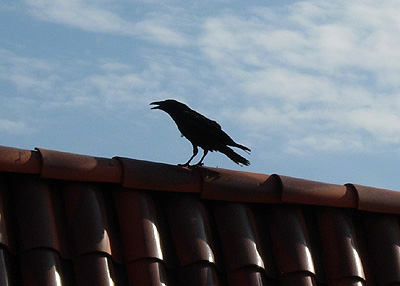
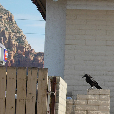
Day two came clear and sunny as I cruised Hwy 89A through Uptown Sedona looking for cheap gas. (This was when $2.25 was pricey.) Filling up at the cheapest place I could find I hear the familiar "Quork" of Ravens coming from behind the Gas Station. After I was done I pulled my car around to find a dozen or so of them leaping in and out of a dumpster. As I stopped to say "Hello" (yes, I talk to Ravens), they stopped their feast with a dazed, slightly embarrassed look. Like a bunch of crazed, drunken frat boys and I was crashing their dumpster-diving party.
Now anyone that knows me, knows that if there are Ravens around, and I have my camera, I'm going to take pictures. This seemed too good an opportunity to miss. The ravens, however, had other ideas. At the sight of my camera all but two took off with loud cries and complaints. The two that remained didn't seem much happier. One perched on the building's rooftop and complained incessantly, the other remained focused on the dumpster, trying to ignore me. They "Quorked" as I took some shots, waiting for me to leave so that they could continue their breakfast in peace.
I said my good byes and left them to their party.
Oak Creek
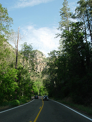
From Sedona I needed to get up on top of the Colorado Plateau toward Flagstaff. The quickest way is up Oak Creek canyon. A drive that starts off along Oak Creek. Normally a small peacefully stream, Oak Creek follows a fault that cuts into the Mogollon Rim.
This past winter the Creek turned into a torrent when powerful winter storms came through the area. Whole sections of the river bank were washes away, leaving bleached white river rocks where lush greenery had once been.
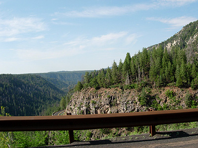
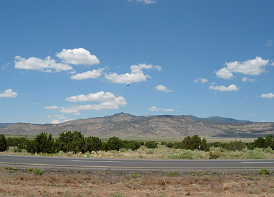
About halfway to Flagstaff the road becomes steeper and twists around on itself as it makes the final push up the rim. The view in the clear air stretched for miles.
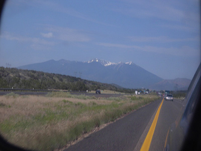
Soon I had reached the Plateau and passed Flagstaff on I-40, leaving the San Francisco Peaks in my rear-view mirror.
Hwy I-40 & New Mexico
Traveling east from Flagstaff the land becomes very flat as the highway passes Winslow and Holbrook. In the distance, out of site to the north, lie the Hopi Mesas. Soon the drive seems as endless as the high plateau. My thoughts begin to meld into the vast distances as the excitement of the drive begins to wear thin. To add to the tedium, the headset to my cell phone as mysteriously broken. At least my truck seems to be doing better today.
Getting closer to the New Mexico border the land starts to rise up on each side of the road with pale red, pink buttes and cliffs.
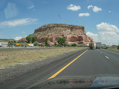
Crossing the border the highway squeezes between them. Built into caves on the north side of the road is the
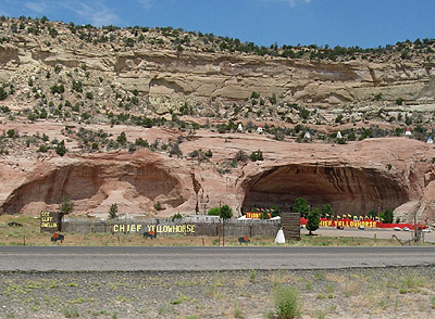
trading post of Chief Yellowhorse and his White Buffalo. The signs say the buffalo are in the caves, I'm not sure where Chief Yellowhorse is...
Gallup, NM
Just past the Arizona - New Mexico border is one the largest towns on Hwy I-40, Gallup. Between it and the highway run the tracks of the Southern Pacific railway, a large part of the local economy. Gallup is a rough and wild town. Full of Trading Posts and other shops that sell Native Made goods. I've never spent much time here, stopping once to visit the Trading Posts and once to have a stone replaced in a bracelet. Today I only take time to get gas (my 4Runner only gets about 260 gallons to a tank). On my way back to the highway though, I spy a Radio Shack. It lies in a run down strip mall, the parking lot torn up by the weight of countless Semi Trucks. Inside, however, it's looks just like any other Radio Shack and they have a replacement for my headset. "They break all the time" I'm told. Everyone is very pleasant and soon I'm back on the road.
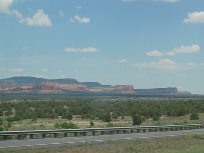
Past Gallup you enter the Red Mesa Valley. A broad valley where hidden from our modern world lie the remains of the "outliers" or suburbs of Chaco Canyon. Then the road crosses the continental divide and Mount Taylor comes into view
Like the San Francisco peaks, Mount Taylor is one of the four mountains that are sacred to the Navajo.
I pass the pueblos of Laguna and Acoma. The Pueblo of Acoma dates back to before AD 1150 and is one of the longest continually occupied towns in North America. (The other being Orabi on the third Hopi mesa.) People were living here when Chaco Canyon and the cliff dwelling of Mesa Verdre were occupied. Also know as the Sky City it sit upon 367 foot mesa in a broad valley. It had a long and troubled history with the Spanish Entrada. The pueblo is known for it's fine pottery. There is a beautiful church that was built by the Acoma people under the directions of the Spanish Padres. The Pueblo itself is made up of rows of terraced apartment like units, that are 2 -3 stories high. Many are still entered by climbing a ladder to the second floor entrance. I've visit the pueblo many times, it is one of my favorite places, but this trip didn't allow time to stop, so I pressed on down the highway.
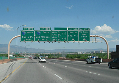
Soon the road begins it's descent into the Rio Grande valley and Albuquerque, which I leave behind pushing toward Santa Fe.
No comments:
Post a Comment